Brbinj
From CruisersWiki
m (bot: Change External Links) |
Istioploos (Talk | contribs) (Template) |
||
| (17 intermediate revisions not shown) | |||
| Line 1: | Line 1: | ||
| - | {{IsPartOf|Mediterranean|Adriatic Sea|Croatia| | + | {{IsPartOf|Mediterranean|Adriatic Sea|Croatia|Northern Dalmatia|Dugi Otok}} |
{{TOC block}} | {{TOC block}} | ||
| - | {{Infobox |44 | + | |
| + | {{Infobox | ||
| + | | lat= 44.07332|lon=15.0037 | ||
| + | | name= Brbinj | ||
| + | | portofentry= | ||
| zoom= 15 | | zoom= 15 | ||
| + | | chartlet = y | ||
| image= BrbinjAerial.jpg | | image= BrbinjAerial.jpg | ||
| - | | imagetext= The bay of Brbinj from S | + | | imagetext= The bay of Brbinj from S |
| - | + | | summary= The harbor of '''Brbinj''' lies on the NE coast of the island of [[Dugi Otok]] ten miles off the mainland coast of [[Croatia]] and facing the island of [[Ugljan]]. Its attractive setting, at the head of a deep bay surrounded by wooded slopes, attracts a modest tourist industry during the summer and it also offers good facilities for visiting yachts on its quay and associated mooring buoys. The harbour and bay offer good shelter in all but E and SE winds. | |
| - | + | ||
| - | + | ||
| - | + | ||
| - | + | ||
| - | The | + | |
| - | + | ||
| - | + | ||
| - | + | ||
| - | + | ||
| - | + | ||
| - | + | Just half a mile N across the isthmus on which the village sits is another harbour with further mooring buoys, [[U. Lucina]], which is also where the Brbinj-Zadar ferry berths. | |
| + | | notes= | ||
| + | | news= | ||
| + | }} | ||
==Charts== | ==Charts== | ||
| - | + | ''See [[Northern Dalmatia#Charts|Northern Dalmatia]]''. | |
| - | + | ||
| - | + | ||
| - | + | ||
| - | + | ||
| - | + | ||
| - | + | ||
| - | == | + | ==Weather== |
| - | + | ''See [[Croatia#Weather|Croatia]]''. | |
| - | + | ||
| - | '' | + | |
==Passages== | ==Passages== | ||
| - | ''See [[Croatia# | + | ''See [[Croatia#Passages|Croatia]]''. |
==Islands== | ==Islands== | ||
* [[Ugljan]] | * [[Ugljan]] | ||
| - | * [[ | + | * [[Pašman]] |
| - | * [[ | + | * [[Iž]] |
| + | |||
| + | ==Communication== | ||
| + | {{Green|Add here VHF channel for the coastguard, harbor masters. etc.}} | ||
| + | * | ||
| + | * | ||
| + | |||
| + | ''Also see [[HF_Radio|Cruiser's Nets]]'' | ||
==Navigation== | ==Navigation== | ||
| - | There are no dangers in the immediate approach to Brbinj. | + | There are no dangers in the immediate approach to '''Brbinj'''. The white-painted light structure on the headland of '''Rt Koromasnjak''' at the N entrance to the bay is conspicuous from some distance. Depths in the approach are considerable until approaching the quay at the head of the inlet, where depths range from 2.0 to 4.0 metres. |
==Entrance== | ==Entrance== | ||
| - | [[ | + | [[Božava]] is the closest seasonal port of entry. The nearest year-round port of entry is [[Zadar]]. |
| - | ==Berthing | + | ==Berthing== |
There are two mooring options for visiting yachts: | There are two mooring options for visiting yachts: | ||
| - | ====Town Quay==== | + | {{poi | lat= 44.07442|lon=15.00212 |
| - | + | | type= harbour | |
| + | | name= Town Quay | ||
| + | | altname= | ||
| + | | url = | ||
| + | | zoom= 17 | ||
| + | | portofentry= | ||
| + | | image= BribinjQuay.jpg | ||
| + | | imagetext= Yachts moored on Brbinj quay | ||
| + | | text= The main town quay lies on the W side of the inlet at the top of the bay. There are laid moorings here for around 20 yachts in depths of 2.0 - 4.0 metres. There is a shoal patch towards the N end of the quay and it is best to go bows-to if mooring here. The shelter is good in winds from all directions except E round to SE. There are water and electricity points on the quay. | ||
| + | }} | ||
| - | The | + | ===Marinas & Yacht Clubs=== |
| + | None. | ||
| + | {{hold vertical}} | ||
| + | ==Anchorages== | ||
| + | {{poi | lat= 44.0744|lon=15.00727 | ||
| + | | type= buoy | ||
| + | | name=Mooring Buoys | ||
| + | | altname= | ||
| + | | url = | ||
| + | | zoom= 16 | ||
| + | | image= BrbinjBuoys.jpg | ||
| + | | imagetext= The mooring buoys off Brbinj | ||
| + | | text= A row of mooring buoys has been laid on the NE side of the bay, just inside the headland of Rt Koromasnjak (the one with the light structure). Depths here are over 10 metres. The buoys are provided with lines ashore as they are extremely close to each other and designed to pack in the maximum number of boats. | ||
| + | }} | ||
| - | ==== | + | {{poi | lat= 44.07004|lon=15.0088 |
| - | + | | type= anchorage | |
| + | | name=SW of the bay | ||
| + | | altname= | ||
| + | | url = | ||
| + | | zoom= 16 | ||
| + | | image= | ||
| + | | imagetext= | ||
| + | | text= There is a useful anchorage in the cove to the SW of the bay. Anchor in 4.0 - 5.0 metres, with a line ashore if possible. Shelter here is good from all directions except NE and E. Holding is moderate to good in sand, mud and weed. | ||
| + | }} | ||
| - | + | ==Amenities== | |
| + | {{tlist | ||
| - | + | |header|Facilities | |
| - | + | ||
| - | === | + | |Water| {{mark | type= water |name= [[#Town Quay|Town Quay]] | lat= 44.07442|lon=15.00212 | zoom=17}} |
| - | + | |Electricity| {{mark | type= electricity |name= [[#Town Quay|Town Quay]] | lat= 44.07442|lon=15.00212 | zoom=17}} | |
| + | |Toilets|N/A (Not Available) | ||
| + | |Showers| N/A | ||
| + | |Laundry| N/A | ||
| + | |Garbage| Bins near the harbour | ||
| - | == | + | |header|Supplies |
| - | + | |Fuel| {{mark| lat= 43.949652|lon=15.144283| type=fuel| name= Nearest in [[Zaglav]] | text=Fuel station at the NW corner of the bay, next to the ferry berth (in season: 07:00-21:00; out of season: 0700-1800). {{Note}} there are only 2 metre depths alongside}} | |
| + | |Bottled gas| None | ||
| + | |Chandlers| None | ||
| - | ==== | + | |header|Services |
| - | + | |Repairs| {{mark | type= service |name= Only in [[Sali]] | lat= 43.93632|lon=15.16879 | zoom={{Magenta|16}} |text= Limited emergency repairs only}} | |
| + | |Internet| N/A | ||
| + | |Mobile connectivity| {{Green|Is there mobile telephone signal such as G4, G3, GPRS on the island? How strong is the signal? Are there any blind spots?}} | ||
| + | |Vehicle rentals| {{mark | type= car |name= Only in [[Sali]] |text=rental outlets in the town}} | ||
| + | }} | ||
| - | == | + | ==Provisioning== |
| - | + | ||
| - | + | ||
| - | + | ||
| - | + | ||
Limited provisions shop near the quay. | Limited provisions shop near the quay. | ||
| - | == | + | ==Eating out== |
Restaurants in the town. | Restaurants in the town. | ||
| - | ==== | + | ==Transportation== |
| - | + | * Ferries to [[Zadar]] from [[U. Lucina]] across the isthmus | |
| + | * Local buses to [[Sali]]. | ||
| - | ==== | + | ==Tourism== |
| - | + | ====Places to Visit==== | |
| + | '''Brbinj''' is one of the prettiest villages along the E shore of the island and in a beautiful, wooded setting. In the SE part of the village are the ruins of the fortified house of the Soppe family, a prominent 16th century Zadar family, which contains a chapel dating from the 17th century. The parish church of Saints Cosmas and Damian dates back to the 14th century, although the present structure is largely from the 15th century. | ||
| - | == | + | ==Friends== |
| - | + | ||
| - | + | ||
| - | + | ||
| - | + | ||
| - | + | ||
| - | + | ||
| - | + | ||
| - | + | ||
| - | + | ||
| - | + | ||
Contact details of "Cruiser's Friends" that can be contacted for local information or assistance. | Contact details of "Cruiser's Friends" that can be contacted for local information or assistance. | ||
* | * | ||
| - | == | + | ==Forums== |
List links to discussion threads on [[Cruising Forums|partnering forums]]. (''see link for requirements'') | List links to discussion threads on [[Cruising Forums|partnering forums]]. (''see link for requirements'') | ||
* | * | ||
| Line 108: | Line 133: | ||
==Links== | ==Links== | ||
* {{wikipedia}} | * {{wikipedia}} | ||
| - | * [http://www. | + | * [http://www.noonsite.com/Countries/Croatia/DugiOtok Noonsite] |
| - | + | ||
| - | ''Also see [[Croatia# | + | ''Also see [[Croatia#Links| Croatia]]''. |
| - | ==References | + | ==References== |
| - | ''See [[Croatia#References | + | ''See [[Croatia#References|Croatia]]''. |
| - | {{Comments | + | {{Comments}} |
| + | * | ||
| + | * | ||
{{Verified by}} | {{Verified by}} | ||
| - | |||
* August 2005 --[[User:Atheneoflymington|Athene of Lymington]] 17:27, 23 April 2012 (BST) | * August 2005 --[[User:Atheneoflymington|Athene of Lymington]] 17:27, 23 April 2012 (BST) | ||
* May 2014 --[[Ariette]] | * May 2014 --[[Ariette]] | ||
Latest revision as of 15:11, 22 March 2019
| Brbinj
| |
| |
 The bay of Brbinj from S |
The harbor of Brbinj lies on the NE coast of the island of Dugi Otok ten miles off the mainland coast of Croatia and facing the island of Ugljan. Its attractive setting, at the head of a deep bay surrounded by wooded slopes, attracts a modest tourist industry during the summer and it also offers good facilities for visiting yachts on its quay and associated mooring buoys. The harbour and bay offer good shelter in all but E and SE winds.
Just half a mile N across the isthmus on which the village sits is another harbour with further mooring buoys, U. Lucina, which is also where the Brbinj-Zadar ferry berths.
Charts
See Northern Dalmatia.
Weather
See Croatia.
Passages
See Croatia.
Islands
Communication
Add here VHF channel for the coastguard, harbor masters. etc.
Also see Cruiser's Nets
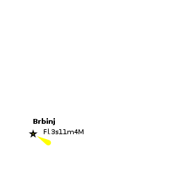
There are no dangers in the immediate approach to Brbinj. The white-painted light structure on the headland of Rt Koromasnjak at the N entrance to the bay is conspicuous from some distance. Depths in the approach are considerable until approaching the quay at the head of the inlet, where depths range from 2.0 to 4.0 metres.
Entrance
Božava is the closest seasonal port of entry. The nearest year-round port of entry is Zadar.
Berthing
There are two mooring options for visiting yachts:

Town Quay
Marinas & Yacht Clubs
None.
Anchorages

Mooring Buoys
SW of the bay
Amenities
| Facilities | |
|---|---|
| Water | |
| Electricity | |
| Toilets | N/A (Not Available) |
| Showers | N/A |
| Laundry | N/A |
| Garbage | Bins near the harbour |
| Supplies | |
| Fuel | |
| Bottled gas | None |
| Chandlers | None |
| Services | |
| Repairs | |
| Internet | N/A |
| Mobile connectivity | Is there mobile telephone signal such as G4, G3, GPRS on the island? How strong is the signal? Are there any blind spots? |
| Vehicle rentals | |
Provisioning
Limited provisions shop near the quay.
Eating out
Restaurants in the town.
Transportation
Tourism
Places to Visit
Brbinj is one of the prettiest villages along the E shore of the island and in a beautiful, wooded setting. In the SE part of the village are the ruins of the fortified house of the Soppe family, a prominent 16th century Zadar family, which contains a chapel dating from the 17th century. The parish church of Saints Cosmas and Damian dates back to the 14th century, although the present structure is largely from the 15th century.
Friends
Contact details of "Cruiser's Friends" that can be contacted for local information or assistance.
Forums
List links to discussion threads on partnering forums. (see link for requirements)
Links
Also see Croatia.
References
See Croatia.
Comments
We welcome users' contributions to the Wiki. Please click on Comments to view other users' comments, add your own personal experiences or recommend any changes to this page following your visit.
Verified by
Date of member's last visit to Brbinj and this page's details validated:
- August 2005 --Athene of Lymington 17:27, 23 April 2012 (BST)
- May 2014 --Ariette
| This is a usable page of the cruising guide. However, please contribute if you can to help it grow further. Click on Comments to add your personal notes on this page or to discuss its contents. Alternatively, if you feel confident to edit the page, click on the edit tab at the top and enter your changes directly. |
| |
|---|
|
Names: Athene of Lymington |