Eivissa
From CruisersWiki
| (86 intermediate revisions not shown) | |||
| Line 1: | Line 1: | ||
| - | + | {{IsPartOf|Mediterranean|Spain|Mediterranean coast of Spain|Costa Blanca|Ibiza}} | |
| - | {{IsPartOf|Mediterranean|Spain| | + | |
{{TOC block}} | {{TOC block}} | ||
| + | |||
{{infobox port | {{infobox port | ||
| - | | lat=38.909|lon=1.44419|zoom= | + | | lat=38.909|lon=1.44419 |
| - | | image= | + | | zoom=14 |
| - | | imagetext= | + | | portofentry=y |
| - | | summary=The main town Ibiza or Eivissa is the largest city and port of the island. The old town | + | | chartlet=y |
| + | | image=Dalt Vila 004.JPG | ||
| + | | imagetext=Dalt Vila, the old town. ''Ibiza Magna'' moorings in the centre | ||
| + | | summary=The main town Ibiza or Eivissa is the largest city and port of the island. The old town within the citadel is very attractive but the modern town on the waterfront is less so. | ||
}} | }} | ||
==Charts== | ==Charts== | ||
| + | ''See [[Ibiza#Charts|Ibiza]]''. | ||
==Weather== | ==Weather== | ||
| + | ''See [[Spain#Weather|Spain]]''. | ||
==Passages== | ==Passages== | ||
| + | These passages can be used for both East to West and for West to East voyages. | ||
| + | |||
| + | * [[Aegean to West Mediterranean Passages]] | ||
| + | * [[East Mediterranean Passages]] | ||
==Islands== | ==Islands== | ||
* [[Formentera]] | * [[Formentera]] | ||
| + | * [[Formentera#Illa S'Espalmador|S'Espalmador]] | ||
| + | * [[Formentera#S'Espardel|S'Espardel]] | ||
| + | * Es Vedrá | ||
| + | * Es Vedranell | ||
| + | |||
| + | ==Communication== | ||
| + | {{contact | ||
| + | | type= officials | ||
| + | | web=http://www.portsdebalears.com/en/ibiza | ||
| + | | name= Autoridad Portuaria de Baleares. Puerto de Eivissa | ||
| + | | altname= Port Authority of the Balearic Islands. Port of Eivissa | ||
| + | | address= Accés Molls Nord, s/n. 07800 Eivissa | ||
| + | | VHF= | ||
| + | | phone= {{phone|34|971|310611}} | ||
| + | | fax= | ||
| + | | email= | ||
| + | | hours= | ||
| + | }} | ||
==Navigation== | ==Navigation== | ||
| - | + | Approaches Ibiza are straightforward but there is a lot of traffic. | |
| - | + | ||
| - | Approaches Ibiza are | + | |
{{Warning}}Approaching or departing Ibiza at night can be very confusing. | {{Warning}}Approaching or departing Ibiza at night can be very confusing. | ||
| - | == | + | ===Approaching from S=== |
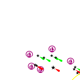
| - | == | + | Take care of islets: |
| + | *{{mark | ||
| + | | type= danger | ||
| + | | name= Dau Gros | ||
| + | | lat= 38.89033 | ||
| + | | lon= 1.45161 | ||
| + | | text= | ||
| + | }} | ||
| + | *{{mark | ||
| + | | type= danger | ||
| + | | name= Dau Petit | ||
| + | | lat= 38.88856 | ||
| + | | lon= 1.45411 | ||
| + | | text= | ||
| + | }} | ||
| + | Next to them there is a {{mark | ||
| + | | type= danger | ||
| + | | name= shipwreck | ||
| + | | lat= 38.88451 | ||
| + | | lon= 1.45190 | ||
| + | | text= | ||
| + | }}. Also further SW take care of {{mark | ||
| + | | type= danger | ||
| + | | name= L'Esponja | ||
| + | | lat= 38.87466 | ||
| + | | lon= 1.42638 | ||
| + | | text= a group of islets and shoals | ||
| + | }}. | ||
| - | + | ===Approaching from W=== | |
| + | Take care of chain of shoals and passages S of Cap D'es Falco. | ||
| - | + | *{{mark | |
| + | | type= danger | ||
| + | | name= Channel Freu Chico | ||
| + | | lat= 38.82831 | ||
| + | | lon= 1.40670 | ||
| + | | text= where the depths are less than 1 m. | ||
| + | }} | ||
| - | {{ | + | *{{mark |
| - | | | + | | type= danger |
| - | | | + | | name= Seca la Barqueta |
| - | | | + | | lat= 38.82506 |
| - | | | + | | lon= 1.40184 |
| - | |text= | + | | text=500 m W Caragolé islet which could be difficult to note at choppy seas. |
| - | }} | + | }} |
| - | {{ | + | *{{mark |
| - | | | + | | type= danger |
| - | | | + | | name= Channel Freu Medianoo |
| - | | | + | | lat= 38.82309 |
| - | | | + | | lon= 1.40980 |
| - | |text= | + | | text= where the depths are up to 3 m. |
| - | }} | + | }} |
| - | {{ | + | *{{mark |
| - | |lat=38. | + | | type= danger |
| - | |type= | + | | name= Channel Freu Grande, Bajo d´en Pou |
| + | | lat= 38.80579 | ||
| + | | lon= 1.41951 | ||
| + | | text= the depths are 6-7 m. Take care of N cardinal mark at the ''Bajo d´en Pou''. | ||
| + | }} | ||
| + | |||
| + | *{{mark | ||
| + | | type= danger | ||
| + | | name= Channel Freu Grande, Bajo de Ahorcados | ||
| + | | lat= 38.81060 | ||
| + | | lon= 1.40742 | ||
| + | | text=550 m SW of ''Illa des Penjats''. | ||
| + | }} | ||
| + | |||
| + | Further W, around ''Punta de la Rana'': | ||
| + | |||
| + | *{{mark | ||
| + | | type= danger | ||
| + | | name= Bajo de Morenallet | ||
| + | | lat= 38.83153 | ||
| + | | lon= 1.37525 | ||
| + | | text=rocks awash 350 m E of Cape Rama. | ||
| + | }} | ||
| + | |||
| + | *{{mark | ||
| + | | type= danger | ||
| + | | name= Farallones de punta Rama | ||
| + | | lat= 38.82881 | ||
| + | | lon= 1.37099 | ||
| + | | text=two low islets islands are 300 m S of Cape Rama. | ||
| + | }} | ||
| + | |||
| + | *{{mark | ||
| + | | type= danger | ||
| + | | name= Wreck | ||
| + | | lat= 38.83047 | ||
| + | | lon= 1.36953 | ||
| + | | text=depth 15 m, approx. 200 m W of Cape Rama. | ||
| + | }} | ||
| + | |||
| + | ==Entrance== | ||
| + | [[{{PAGENAME}}]] is a port of entry for Spain. For details ''see [[Spain#Entrance|Entrance: Spain]]''. | ||
| + | |||
| + | ==Berthing== | ||
| + | {{thumb|Eivissa - Portua.jpg|Panorama of the port, view from S}} | ||
| + | This is a fairly large harbor and it's well sheltered from all weather. | ||
| + | |||
| + | ===Marinas & Yacht Clubs=== | ||
| + | Four berthing options can be found there. In any case, an advance reservation in season is essential: | ||
| + | * {{dest|Marina Botafoch|m}} | ||
| + | * {{dest|Marina Ibiza|m|text=(aka Ibiza Nueva)}} | ||
| + | * {{mark | ||
| + | |lat=38.91321|lon=1.43723 | ||
| + | |type=marina | ||
|name=Club Nautico Ibiza | |name=Club Nautico Ibiza | ||
| - | | | + | |url=http://www.clubnauticoibiza.com |
|text= | |text= | ||
| - | }} | + | }} |
| - | + | * {{mark | |
| - | {{ | + | |lat=38.91114|lon=1.43683 |
| - | |lat=38.91114|lon=1.43683 | + | |type= marina |
| - | |type= | + | |
|name=Ibiza Magna | |name=Ibiza Magna | ||
| - | | | + | |url=http://www.ibizamagna.com/ |
|text= | |text= | ||
| + | }} | ||
| + | * {{mark | ||
| + | |lat=38.9104|lon=1.43935 | ||
| + | |type= marina | ||
| + | |name=PortIbizaTown | ||
| + | |url=http://www.portibizatown.com | ||
| + | |text=Megayacht moorings; minimum length 60 m | ||
}} | }} | ||
==Anchorages== | ==Anchorages== | ||
| + | ===Eivissa=== | ||
| + | {{Warning}} It is prohibited to anchor inside the harbour. | ||
| + | |||
| + | The nearest anchorage can be found at: | ||
{{poi | {{poi | ||
| type= anchorage | | type= anchorage | ||
| Line 70: | Line 192: | ||
| lat= 38.91264 | | lat= 38.91264 | ||
| lon= 1.45715 | | lon= 1.45715 | ||
| - | | text= | + | | text=A big open bay just E of the harbour of Eivissa. It's protected from W by ''Punta Grossa'', but exposed from SW to E. The bay is very shallow and the bottom is rock and weed, so you shouldn't anchor where there the depths are less than 3 m. Perhaps a better place is next to ''Punta Tabernera'' (Sa Tabernera) on some sand and weed. The shore is low. At the W corner there is a small jetty suitable for dingies. |
}} | }} | ||
| - | == | + | ===E and NE of Eivissa=== |
| - | + | {{poi | |
| - | In | + | | type= buoy |
| + | | name= Ses Salines | ||
| + | | lat= 38.83784 | ||
| + | | lon= 1.39132 | ||
| + | | url=http://www.balearslifeposidonia.eu/fondeiglic.php?id=516®ister_vars%5Blang%5D=en | ||
| + | | text=This anchorage is located at a protected area. In season (Jun-Sep) this anchorage is a managed ''buoy only'' field. See [[Balearic_Islands#Anchorages]] for more details. | ||
| + | }} | ||
| - | + | {{poi | |
| - | + | | type= anchorage | |
| + | | name= Cala Yondal | ||
| + | | altname= Jondal | ||
| + | | lat= 38.86451 | ||
| + | | lon= 1.31518 | ||
| + | | text= A large open bay. It quite well protected from NW-N-NE. Anchor at 6-10 m. The bottom is sand, shingle, weed. Ashore is a busy beach and a number of restaurants. | ||
| - | + | {{Danger}} Beware of a submarine cable in the middle of the bay. | |
| - | + | }} | |
| - | + | {{poi | |
| - | + | | type= anchorage | |
| + | | name= Cala de Porroig | ||
| + | | altname= Port Roig | ||
| + | | lat= 38.86715 | ||
| + | | lon= 1.30222 | ||
| + | | text= A relatively large cove . Some stones at the bottom and a few permanent moorings are there. Anchor at 4-6 m. The bottom is sand, weed and rock. The protection is quite good except from SW. A few residential buildings ashore. No tourism. | ||
| + | }} | ||
| - | + | {{poi | |
| - | + | | type= anchorage | |
| + | | lat=38.86279|lon=1.25521 | ||
| + | | name= Cala Llentrisca | ||
| + | | text= A small cove surrounded by green hills. There are a few ubiquitous fishermen's huts ashore, but it's quiet there. Anchor at 4-6 m on sand and rock. | ||
| + | }} | ||
| + | |||
| + | {{poi | ||
| + | | type= anchorage | ||
| + | | name= El Materet | ||
| + | | lat= 38.87413 | ||
| + | | lon= 1.21845 | ||
| + | | text=A wide sand bar between the islet of Vedranell and the cape Blanc. In settled weather it's possible to drop an anchor there. Someone has suggested the place is good for snorkeling. Anchor at 12 m on sand and rock provided the weather is good. | ||
| + | }} | ||
| - | + | {{poi | |
| - | + | | lat= 38.87156|lon=1.19739 | |
| + | | type= anchorage | ||
| + | | name= Isla Vedrá | ||
| + | | text=A rather dramatic island with a high ridge in the middle. In settled weather it may be possible to make a day stop at the N of the island next to a rocky islet of Sa Galera. | ||
| - | + | {{danger}} Beware of some rocky outcrops at the NE shore of the island. | |
| - | + | }} | |
| - | + | ||
| - | + | {{poi | |
| - | + | | type= anchorage | |
| + | | name= Cala d'Hort | ||
| + | | lat= 38.88903 | ||
| + | | lon= 1.22262 | ||
| + | | text=A rather open bay with a rather dramatic view of two islands of Vedrá and Vedranell which provide some protection from S. Anchor at 5-10 m on sand. A shore is a beach which could be crowded in season. A couple of restaurants are there. | ||
| - | + | {{mark | |
| - | + | | type= danger | |
| + | | name= Bajo de la Bota | ||
| + | | url=http://www.aquarama.travel/zonas-y-lugares/buceo/bajo-de-la-bota-de-es-vedra | ||
| + | | lat= 38.87985 | ||
| + | | lon= 1.17931 | ||
| + | | text=Beware of a rock awash 1 mile NW Vedra island. | ||
| + | }} | ||
| + | }} | ||
| - | == | + | {{poi |
| - | + | | type= anchorage | |
| - | + | | name= Cala Vedella | |
| + | | altname= Badella | ||
| + | | lat= 38.91480 | ||
| + | | lon= 1.22023 | ||
| + | | text= It's a deep cove protected by high cliffs, but there are plenty of private moorings there, so it could be quite full in season. Ashore plenty of tourist infrastructure with restaurants, bars and grocery shops, so someone could find it overdeveloped. | ||
| + | }} | ||
| - | + | {{poi | |
| - | + | | type= anchorage | |
| + | | name= Cala Molí | ||
| + | | lat= 38.93014 | ||
| + | | lon= 1.23223 | ||
| + | | text= A tiny beautiful green cove only suitable for a couple of boats. Anchor at 5 m, on sand. Ashore a beach which isn't usually crowded and a restaurant. | ||
| + | }} | ||
| - | + | {{poi | |
| - | + | | type= anchorage | |
| + | | name= Cala Tarida | ||
| + | | lat= 38.93879 | ||
| + | | lon= 1.23284 | ||
| + | | text= An larger open bay with a few rocks closer to the beach. Given a proper weather it's quite usable for an overnight stay: anchor at 4-5 m on sand, weed and rocks. A fairly developed tourist infrastructure ashore with a few restaurants and a grocery shops ashore. | ||
| + | }} | ||
| - | + | {{poi|lat=38.94399|lon=1.22751 | |
| - | + | | type= anchorage | |
| + | | name= Cala Corral | ||
| + | | text= Open from S to W. There is a rocky shoal at the entrance. Closer to the head at becomes sandy. Anchor at 5-6 m. At the head of the cove there is a tiny private harbour of ''Marina Coralmar'' which is shallow and suitable only for small boats(depth 1-1.5m, max. LOA 10m). Ashore some touristic buildings a restaurant and a grocery shop. | ||
| + | }} | ||
| + | |||
| + | {{poi | ||
| + | | type= anchorage | ||
| + | | name= Cala Llentía | ||
| + | | lat= 38.94679|lon=1.22686 | ||
| + | | text= A small rocky cove open to S-SW. Anchor in front of the beach at 5 m on sand. | ||
| + | }} | ||
| + | |||
| + | {{poi | ||
| + | | type= anchorage | ||
| + | | name= Cala Codolá | ||
| + | | altname= Codolar | ||
| + | | lat= 38.94966 | ||
| + | | lon= 1.22540 | ||
| + | | text=Anchor closer to it's head at 4-6 m, on sand and weed. Ashore are a restaurant, a bar and some shops. | ||
| + | }} | ||
| + | |||
| + | ==Amenities== | ||
| + | {{tlist | ||
| + | |||
| + | |header|Facilities | ||
| + | |Water|In the marinas | ||
| + | |Electricity|In the marinas | ||
| + | |Toilets|In the marinas | ||
| + | |Showers|In the marinas | ||
| + | |Laundry| In the [[Marina Ibiza]] | ||
| + | |Garbage|In the marinas | ||
| + | |||
| + | |header|Supplies | ||
| + | |Fuel| See [[Marina Ibiza]] and [[Marina Botafoch]] | ||
| + | |Bottled gas| | ||
| + | |Chandlers| | ||
| + | |||
| + | |header|Services | ||
| + | |Repairs| See [[Marina Ibiza]] and [[Marina Botafoch]] | ||
| + | |Internet| | ||
| + | |Mobile connectivity| Good | ||
| + | |Vehicle rentals| Outlets in the city and at the [[Marina Ibiza]] | ||
| + | }} | ||
==Provisioning== | ==Provisioning== | ||
| + | There are plenty of the shops of various kinds in the city. Just to name a few: | ||
| + | |||
| + | {{pin| lat=38.90912|lon=1.43447 | ||
| + | | type=provisions | ||
| + | | name=SPAR | ||
| + | | text=A tiny cramped grocery shop appears to be the closest one to the ''Ibiza Magna'' moorings: at the E corner of the ''Plaça del Parc'' next to the old town walls (Carrer d'Abel Matutes Torres). | ||
| + | }} | ||
| + | |||
| + | {{pin| lat=38.90796|lon=1.43172 | ||
| + | | type=provisions | ||
| + | | name=Eroski City | ||
| + | | text=A small supermarket is a bit further W (Via Punica, 11 bis). | ||
| + | }} | ||
| + | |||
| + | {{pin| lat=38.92061|lon=1.44079 | ||
| + | | type=provisions | ||
| + | | name=Eroski | ||
| + | | text=A hypermarket at the N edge of the city. It's relatively close to the ''Marina Ibiza''. | ||
| + | }} | ||
==Eating out== | ==Eating out== | ||
| Line 121: | Line 361: | ||
==Transportation== | ==Transportation== | ||
| + | Buses to other locations on the island. | ||
| + | For getting into the island see [[Ibiza]]. | ||
==Tourism== | ==Tourism== | ||
| + | {{thumb|Ibiza - panoramio - anibal amaro (7).jpg|At the old Town}} | ||
The citadel and the old town is a delight to walk. The Cathedral and some museums are worth a visit. | The citadel and the old town is a delight to walk. The Cathedral and some museums are worth a visit. | ||
| - | |||
| - | |||
| - | |||
| - | |||
| - | |||
==Friends== | ==Friends== | ||
| Line 145: | Line 383: | ||
==References== | ==References== | ||
| - | ''See [[ | + | ''See [[Balearics#References|Balearics]]''. |
| - | {{Comments | + | {{Comments}} |
| + | * | ||
{{Verified by}} | {{Verified by}} | ||
| - | + | * October 2004 --[[User:Istioploos|Istioploos]] [[Image:Greece_Icon.png]] [[File:Sailboat_favicon.png]] [http://www.sy-thetis.org Travels with S/Y Thetis] 13:55, 30 June 2008 (MDT) | |
* October 2015 --[[User:Vadim|Vadim]] | * October 2015 --[[User:Vadim|Vadim]] | ||
| - | + | ||
| - | {{Page | + | {{Page usable}} |
{{Contributors|[[User:Vadim|Vadim]]}} | {{Contributors|[[User:Vadim|Vadim]]}} | ||
| - | [[Category:Ports - | + | [[Category:Ports - Spain]] [[Category:Anchorages - Spain]] [[Category:Marinas - Spain]] |
Latest revision as of 20:12, 14 January 2020
| Eivissa Port of Entry
| |
| |
 Dalt Vila, the old town. Ibiza Magna moorings in the centre |
The main town Ibiza or Eivissa is the largest city and port of the island. The old town within the citadel is very attractive but the modern town on the waterfront is less so.
Charts
See Ibiza.
Weather
See Spain.
Passages
These passages can be used for both East to West and for West to East voyages.
Islands
- Formentera
- S'Espalmador
- S'Espardel
- Es Vedrá
- Es Vedranell
Communication
Autoridad Portuaria de Baleares. Puerto de Eivissa
- Phone: +34 (971) 310611
- Web: http://www.portsdebalears.com/en/ibiza
- Address: Accés Molls Nord, s/n. 07800 Eivissa
Approaches Ibiza are straightforward but there is a lot of traffic.
Warning: Approaching or departing Ibiza at night can be very confusing.
Approaching from S
Take care of islets:
 Dau Gros [[Eivissa#Dau Gros|Dau Gros]] 38°53.420'N, 001°27.097'E
- Dau Petit [[Eivissa#Dau Petit|Dau Petit]] 38°53.314'N, 001°27.247'E
Next to them there is a ![]() shipwreck [[Eivissa#shipwreck|shipwreck]] 38°53.071'N, 001°27.114'E . Also further SW take care of
shipwreck [[Eivissa#shipwreck|shipwreck]] 38°53.071'N, 001°27.114'E . Also further SW take care of ![]() L'Esponja [[Eivissa#L'Esponja|L'Esponja]] 38°52.480'N, 001°25.583'E a group of islets and shoals.
L'Esponja [[Eivissa#L'Esponja|L'Esponja]] 38°52.480'N, 001°25.583'E a group of islets and shoals.
Approaching from W
Take care of chain of shoals and passages S of Cap D'es Falco.
- Channel Freu Chico [[Eivissa#Channel Freu Chico|Channel Freu Chico]] 38°49.699'N, 001°24.402'E where the depths are less than 1 m.
- Seca la Barqueta [[Eivissa#Seca la Barqueta|Seca la Barqueta]] 38°49.504'N, 001°24.110'E 500 m W Caragolé islet which could be difficult to note at choppy seas.
- Channel Freu Medianoo [[Eivissa#Channel Freu Medianoo|Channel Freu Medianoo]] 38°49.385'N, 001°24.588'E where the depths are up to 3 m.
- Channel Freu Grande, Bajo d´en Pou [[Eivissa#Channel Freu Grande, Bajo d´en Pou|Channel Freu Grande, Bajo d´en Pou]] 38°48.347'N, 001°25.171'E the depths are 6-7 m. Take care of N cardinal mark at the Bajo d´en Pou.
- Channel Freu Grande, Bajo de Ahorcados [[Eivissa#Channel Freu Grande, Bajo de Ahorcados|Channel Freu Grande, Bajo de Ahorcados]] 38°48.636'N, 001°24.445'E 550 m SW of Illa des Penjats.
Further W, around Punta de la Rana:
- Bajo de Morenallet [[Eivissa#Bajo de Morenallet|Bajo de Morenallet]] 38°49.892'N, 001°22.515'E rocks awash 350 m E of Cape Rama.
- Farallones de punta Rama [[Eivissa#Farallones de punta Rama|Farallones de punta Rama]] 38°49.729'N, 001°22.259'E two low islets islands are 300 m S of Cape Rama.
- Wreck [[Eivissa#Wreck|Wreck]] 38°49.828'N, 001°22.172'E depth 15 m, approx. 200 m W of Cape Rama.
Entrance
Eivissa is a port of entry for Spain. For details see Entrance: Spain.
Berthing

This is a fairly large harbor and it's well sheltered from all weather.
Marinas & Yacht Clubs
Four berthing options can be found there. In any case, an advance reservation in season is essential:
- Marina Botafoch |
 – marina |
 -
 Club Nautico Ibiza [[Eivissa#Club Nautico Ibiza|Club Nautico Ibiza]] 38°54.793'N, 001°26.234'E
- Ibiza Magna [[Eivissa#Ibiza Magna|Ibiza Magna]] 38°54.668'N, 001°26.210'E
- PortIbizaTown [[Eivissa#PortIbizaTown|PortIbizaTown]] 38°54.624'N, 001°26.361'E Megayacht moorings; minimum length 60 m
Anchorages
Eivissa
Warning: It is prohibited to anchor inside the harbour.
The nearest anchorage can be found at:
Cala Talamanca
E and NE of Eivissa
Ses Salines
Cala Yondal
A large open bay. It quite well protected from NW-N-NE. Anchor at 6-10 m. The bottom is sand, shingle, weed. Ashore is a busy beach and a number of restaurants.
Danger: Beware of a submarine cable in the middle of the bay.Cala de Porroig
Cala Llentrisca
El Materet
Isla Vedrá
A rather dramatic island with a high ridge in the middle. In settled weather it may be possible to make a day stop at the N of the island next to a rocky islet of Sa Galera.
Danger: Beware of some rocky outcrops at the NE shore of the island.Cala d'Hort
A rather open bay with a rather dramatic view of two islands of Vedrá and Vedranell which provide some protection from S. Anchor at 5-10 m on sand. A shore is a beach which could be crowded in season. A couple of restaurants are there.
Cala Vedella
Cala Molí
Cala Tarida
Cala Corral
Cala Llentía
Cala Codolá
Amenities
| Facilities | |
|---|---|
| Water | In the marinas |
| Electricity | In the marinas |
| Toilets | In the marinas |
| Showers | In the marinas |
| Laundry | In the Marina Ibiza |
| Garbage | In the marinas |
| Supplies | |
| Fuel | See Marina Ibiza and Marina Botafoch |
| Bottled gas | |
| Chandlers | |
| Services | |
| Repairs | See Marina Ibiza and Marina Botafoch |
| Internet | |
| Mobile connectivity | Good |
| Vehicle rentals | Outlets in the city and at the Marina Ibiza |
Provisioning
There are plenty of the shops of various kinds in the city. Just to name a few:
![]() SPAR [[Eivissa#SPAR|SPAR]] A tiny cramped grocery shop appears to be the closest one to the Ibiza Magna moorings: at the E corner of the Plaça del Parc next to the old town walls (Carrer d'Abel Matutes Torres).
SPAR [[Eivissa#SPAR|SPAR]] A tiny cramped grocery shop appears to be the closest one to the Ibiza Magna moorings: at the E corner of the Plaça del Parc next to the old town walls (Carrer d'Abel Matutes Torres).
![]() Eroski City [[Eivissa#Eroski City|Eroski City]] A small supermarket is a bit further W (Via Punica, 11 bis).
Eroski City [[Eivissa#Eroski City|Eroski City]] A small supermarket is a bit further W (Via Punica, 11 bis).
![]() Eroski [[Eivissa#Eroski|Eroski]] A hypermarket at the N edge of the city. It's relatively close to the Marina Ibiza.
Eroski [[Eivissa#Eroski|Eroski]] A hypermarket at the N edge of the city. It's relatively close to the Marina Ibiza.
Eating out
Numerous restaurants along the waterfront and up on the citadel
Transportation
Buses to other locations on the island.
For getting into the island see Ibiza.
Tourism

The citadel and the old town is a delight to walk. The Cathedral and some museums are worth a visit.
Friends
Contact details of "Cruiser's Friends" that can be contacted for local information or assistance.
Discussions
List links to discussion threads on partnering forums. (see link for requirements)
Links
References
See Balearics.
Comments
We welcome users' contributions to the Wiki. Please click on Comments to view other users' comments, add your own personal experiences or recommend any changes to this page following your visit.
Verified by
Date of member's last visit to Eivissa and this page's details validated:
- October 2004 --Istioploos

 Travels with S/Y Thetis 13:55, 30 June 2008 (MDT)
- October 2015 --Vadim
| This is a usable page of the cruising guide. However, please contribute if you can to help it grow further. Click on Comments to add your personal notes on this page or to discuss its contents. Alternatively, if you feel confident to edit the page, click on the edit tab at the top and enter your changes directly. |
| |
|---|
|
Names: Vadim |