Žman
From CruisersWiki
m (bot: Change Radio Nets) |
Istioploos (Talk | contribs) (Template) |
||
| (21 intermediate revisions not shown) | |||
| Line 1: | Line 1: | ||
| - | {{IsPartOf|Mediterranean|Adriatic Sea|Croatia| | + | {{IsPartOf|Mediterranean|Adriatic Sea|Croatia|Northern Dalmatia|Dugi Otok}} |
{{TOC block}} | {{TOC block}} | ||
| - | {{Infobox |43 | + | |
| + | {{Infobox | ||
| + | | lat= 43.97124|lon=15.11658 | ||
| + | | name= Žman (U. Žmanšćica) | ||
| + | | portofentry= | ||
| zoom= 17 | | zoom= 17 | ||
| + | | chartlet = y | ||
| image= ZmanscicaChart.jpg | | image= ZmanscicaChart.jpg | ||
| - | | imagetext= Chart of Zmanscica harbour | + | | imagetext= Chart of Zmanscica harbour |
| - | + | | summary= The small harbour of '''Žman''' lies at the head of ''U. Žmanšćica'' on the SE coast of the island of [[Dugi Otok]] off the mainland coast of [[Croatia]], four miles NW of the settlement of [[Sali]]. Primarily a fishing port, its inner harbour is crammed with local small craft. However, the breakwater that protects the harbour from SE winds has been quayed and moorings laid for visiting yachts, together with electricity and water points. Shelter in the harbour is good from the prevailing winds but it is completely open E and strong NE or E winds would probably make it untenable. | |
| - | The small harbour of | + | | notes= |
| - | + | | news= | |
| - | + | }} | |
| - | + | ||
| - | + | ||
| - | + | ||
| - | + | ||
| - | + | ||
| - | + | ||
==Charts== | ==Charts== | ||
| - | + | ''See [[Northern Dalmatia#Charts|Northern Dalmatia]]''. | |
| - | + | ||
| - | + | ||
| - | + | ||
| - | + | ||
| - | + | ||
| - | + | ||
| - | == | + | ==Weather== |
| - | + | ''See [[Croatia#Weather|Croatia]]''. | |
| - | '' | + | ==Passages== |
| + | ''See [[Croatia#Passages|Croatia]]''. | ||
==Islands== | ==Islands== | ||
* [[Ugljan]] | * [[Ugljan]] | ||
| - | * [[ | + | * [[Pašman]] |
* [[Kornat]] | * [[Kornat]] | ||
| + | |||
| + | ==Communication== | ||
| + | {{Green|Add here VHF channel for the coastguard, harbor masters. etc.}} | ||
| + | * | ||
| + | * | ||
| + | |||
| + | ''Also see [[HF_Radio|Cruiser's Nets]]'' | ||
==Navigation== | ==Navigation== | ||
| - | There are no dangers in the immediate approach to Zmanscica. | + | There are no dangers in the immediate approach to Zmanscica. Once closer in, the harbour breakwater is easily identifiable by the legend ‘ZMAN’ painted on it. The harbour is entered from the ENE. Depths in the entrance are 5.0 - 6.0 metres and on the quay 3.0 - 5.0 metres. |
| + | |||
| + | {{Warning}}There are several {{mark|type=danger|name=reefs|lat=43.97103|lon=15.11599|zoom=18}} near the harbour entrance. | ||
==Entrance== | ==Entrance== | ||
| - | Sali is the closest seasonal port of entry. | + | [[Sali]] is the closest seasonal port of entry. The nearest year-round port of entry is [[Zadar]]. |
| - | ==Berthing | + | ==Berthing== |
| - | {{ | + | {{poi | lat=43.9708|lon=15.1161 |
| + | | type= harbour | ||
| + | | name= Žmanšćica Harbour | ||
| + | | altname= | ||
| + | | url = | ||
| + | | zoom= 17 | ||
| + | | portofentry= | ||
| + | | image= ZmanscicaHarbour.jpg | ||
| + | | imagetext= The tiny inner harbour of Zmanscica | ||
| + | | text= Visiting yachts berth stern or bows-to on the inside of the breakwater, where there are around 20 laid mooring lines in depths of 3.0 - 5.0 metres. Shelter is good in winds from all directions except NE and E. | ||
| + | |||
| + | There are water and electricity points along the quay. | ||
| - | + | {{Note}} the inner harbour is shallow and unsuitable for yachts. | |
| + | }} | ||
===Marinas & Yacht Clubs=== | ===Marinas & Yacht Clubs=== | ||
None. | None. | ||
| - | + | ==Anchorages== | |
| - | + | If all the moorings are taken, it is also possible to anchor off N of the harbour in 4.0 - 5.0 metres. Holding here is good in sand and weed but the shelter is less good than in the harbour. | |
| - | == | + | ==Amenities== |
| - | + | {{tlist | |
| - | + | |header|Facilities | |
| - | + | ||
| - | == | + | |Water| {{mark | type= water |name= | lat=43.9708|lon=15.1161 | zoom=17|text=at the quay}} |
| - | ==== | + | |Electricity| {{mark | type= electricity |name= | lat=43.9708|lon=15.1161 | zoom=17|text=at the quay}} |
| - | + | |Toilets|N/A (Not Available) | |
| + | |Showers| N/A | ||
| + | |Laundry| N/A | ||
| + | |Garbage| Bins near the harbour | ||
| - | ==== | + | |header|Supplies |
| - | + | |Fuel| {{mark| lat= 43.949652|lon=15.144283| type=fuel| name=[[Zaglav]] | text=Nearest fuel station at the NW corner of the bay, next to the ferry berth (in season: 07:00-21:00; out of season: 0700-1800). {{Note}} there are only 2 metre depths alongside}} | |
| + | |Bottled gas| None | ||
| + | |Chandlers| None | ||
| - | ==== | + | |header|Services |
| - | + | |Repairs| {{mark | type= service |name= [[Sali]] | lat= 43.93632|lon=15.16879 | zoom={{Magenta|16}} |text= Limited emergency repairs only}} | |
| + | |Internet| N/A | ||
| + | |Mobile connectivity| {{Green|Is there mobile telephone signal such as G4, G3, GPRS on the island? How strong is the signal? Are there any blind spots?}} | ||
| + | |Vehicle rentals| N/A | ||
| - | + | }} | |
| - | + | ||
| - | == | + | ==Provisioning== |
| - | + | Provisions shop in the village. | |
| - | == | + | ==Eating out== |
| - | + | Restaurant on NW side of the harbour. | |
| - | + | ||
| - | + | ||
| - | + | ||
| - | + | ==Transportation== | |
Local buses only. | Local buses only. | ||
| - | == | + | ==Tourism== |
| - | + | ====Places to Visit==== | |
| + | There is little of tourist interest in Žman village, although it is an attractive and peaceful spot. | ||
| - | == | + | ==Friends== |
Contact details of "Cruiser's Friends" that can be contacted for local information or assistance. | Contact details of "Cruiser's Friends" that can be contacted for local information or assistance. | ||
* | * | ||
| - | == | + | ==Forums== |
List links to discussion threads on [[Cruising Forums|partnering forums]]. (''see link for requirements'') | List links to discussion threads on [[Cruising Forums|partnering forums]]. (''see link for requirements'') | ||
* | * | ||
| - | == | + | ==Links== |
| + | * {{Wikipedia}} | ||
* [http://www.telascica.hr/index.php/ Telascica Nature Park] | * [http://www.telascica.hr/index.php/ Telascica Nature Park] | ||
* [http://kornati.hr/eng/ Kornati National Park] | * [http://kornati.hr/eng/ Kornati National Park] | ||
| - | ''Also see [[Croatia# | + | ''Also see [[Croatia#Links| Croatia]]''. |
| - | ==References | + | ==References== |
| - | ''See [[Croatia#References | + | ''See [[Croatia#References|Croatia]]''. |
| - | {{Comments | + | {{Comments}} |
| + | * | ||
{{Verified by}} | {{Verified by}} | ||
| - | |||
* August 2005 --[[User:Atheneoflymington|Athene of Lymington]] 17:27, 23 April 2012 (BST) | * August 2005 --[[User:Atheneoflymington|Athene of Lymington]] 17:27, 23 April 2012 (BST) | ||
* | * | ||
| Line 115: | Line 135: | ||
{{Contributors|[[User:Atheneoflymington|Athene of Lymington]]}} | {{Contributors|[[User:Atheneoflymington|Athene of Lymington]]}} | ||
| - | [[Category:Ports - Croatia]] | + | [[Category:Ports - Croatia]] [[Category:Anchorages - Croatia]] |
Latest revision as of 21:11, 21 March 2019
| Žman (U. Žmanšćica)
| |
| |
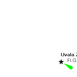
 Chart of Zmanscica harbour |
The small harbour of Žman lies at the head of U. Žmanšćica on the SE coast of the island of Dugi Otok off the mainland coast of Croatia, four miles NW of the settlement of Sali. Primarily a fishing port, its inner harbour is crammed with local small craft. However, the breakwater that protects the harbour from SE winds has been quayed and moorings laid for visiting yachts, together with electricity and water points. Shelter in the harbour is good from the prevailing winds but it is completely open E and strong NE or E winds would probably make it untenable.
Charts
See Northern Dalmatia.
Weather
See Croatia.
Passages
See Croatia.
Islands
Communication
Add here VHF channel for the coastguard, harbor masters. etc.
Also see Cruiser's Nets
There are no dangers in the immediate approach to Zmanscica. Once closer in, the harbour breakwater is easily identifiable by the legend ‘ZMAN’ painted on it. The harbour is entered from the ENE. Depths in the entrance are 5.0 - 6.0 metres and on the quay 3.0 - 5.0 metres.
Warning: There are several ![]() reefs [[Žman#reefs|reefs]] 43°58.262'N, 015°06.959'E near the harbour entrance.
reefs [[Žman#reefs|reefs]] 43°58.262'N, 015°06.959'E near the harbour entrance.
Entrance
Sali is the closest seasonal port of entry. The nearest year-round port of entry is Zadar.
Berthing

Žmanšćica Harbour
Visiting yachts berth stern or bows-to on the inside of the breakwater, where there are around 20 laid mooring lines in depths of 3.0 - 5.0 metres. Shelter is good in winds from all directions except NE and E.
There are water and electricity points along the quay.
Note: the inner harbour is shallow and unsuitable for yachts.Marinas & Yacht Clubs
None.
Anchorages
If all the moorings are taken, it is also possible to anchor off N of the harbour in 4.0 - 5.0 metres. Holding here is good in sand and weed but the shelter is less good than in the harbour.
Amenities
| Facilities | |
|---|---|
| Water | |
| Electricity | |
| Toilets | N/A (Not Available) |
| Showers | N/A |
| Laundry | N/A |
| Garbage | Bins near the harbour |
| Supplies | |
| Fuel | |
| Bottled gas | None |
| Chandlers | None |
| Services | |
| Repairs | |
| Internet | N/A |
| Mobile connectivity | Is there mobile telephone signal such as G4, G3, GPRS on the island? How strong is the signal? Are there any blind spots? |
| Vehicle rentals | N/A |
Provisioning
Provisions shop in the village.
Eating out
Restaurant on NW side of the harbour.
Transportation
Local buses only.
Tourism
Places to Visit
There is little of tourist interest in Žman village, although it is an attractive and peaceful spot.
Friends
Contact details of "Cruiser's Friends" that can be contacted for local information or assistance.
Forums
List links to discussion threads on partnering forums. (see link for requirements)
Links
- Žman at the Wikipedia
- Telascica Nature Park
- Kornati National Park
Also see Croatia.
References
See Croatia.
Comments
We welcome users' contributions to the Wiki. Please click on Comments to view other users' comments, add your own personal experiences or recommend any changes to this page following your visit.
Verified by
Date of member's last visit to Žman and this page's details validated:
- August 2005 --Athene of Lymington 17:27, 23 April 2012 (BST)
| This is a usable page of the cruising guide. However, please contribute if you can to help it grow further. Click on Comments to add your personal notes on this page or to discuss its contents. Alternatively, if you feel confident to edit the page, click on the edit tab at the top and enter your changes directly. |
| |
|---|
|
Names: Athene of Lymington |