Brna
From CruisersWiki
m (bot: Friends) |
Istioploos (Talk | contribs) (Template) |
||
| (15 intermediate revisions not shown) | |||
| Line 1: | Line 1: | ||
| - | {{IsPartOf|Mediterranean|Adriatic Sea|Croatia| | + | {{IsPartOf|Mediterranean|Adriatic Sea|Croatia|Southern Dalmatia|Korčula}} |
{{TOC block}} | {{TOC block}} | ||
| - | {{Infobox |42 | + | |
| - | | zoom= | + | {{Infobox |
| + | | lat=42.90283|lon=16.85011 | ||
| + | | name= Brna | ||
| + | | zoom= 14 | ||
| + | | chartlet=y | ||
| image= BrnaAerial.jpg | | image= BrnaAerial.jpg | ||
| - | | imagetext= The harbour of Brna from S | + | | imagetext= The harbour of Brna from the S |
| - | + | | summary=The small harbour of [[Brna]] lies on the S coast of the island of [[Korčula]] in [[Croatia]], nine miles E of the SW tip of the island and just over two miles E of the harbour of [[Prižba]]. | |
| - | + | ||
| - | + | ||
| - | + | ||
| - | + | ||
| - | The small harbour of Brna lies on the S coast of the island of [[ | + | |
| - | + | It lies in the wide bay of [[#Luka Brna|Luka Brna]], which is open to the SW and divides into two branches at its head. | |
| - | + | ||
| - | + | A rather cramped harbour lies in the SE branch, whereas the NW branch is a quiet and attractive anchorage. The quays of the harbour are too shallow for most yachts, but it is possible to go alongside in greater depths on the ends of two jetties on the N side of the harbour. Shelter in Brna is good except in winds from the W or the SW, which send in a swell. | |
| - | + | }} | |
| - | + | ||
==Charts== | ==Charts== | ||
| - | + | ''See [[Southern Dalmatia#Charts|Southern Dalmatia]]''. | |
| - | + | ||
| - | + | ||
| - | + | ||
| - | + | ||
| - | + | ||
| - | + | ||
| - | + | ||
| - | + | ||
==Weather== | ==Weather== | ||
| - | + | ''See [[Croatia#Weather|Croatia]]''. | |
| - | + | ||
| - | + | ||
| - | + | ||
| - | + | ||
==Passages== | ==Passages== | ||
{{Green|List popular passages/routes, timing, etc.}} | {{Green|List popular passages/routes, timing, etc.}} | ||
| + | * | ||
| + | |||
| + | ==Communication== | ||
| + | {{Green|Add here VHF channel for coastguard, harbor masters. etc.}} | ||
* | * | ||
* | * | ||
| + | |||
| + | ''Also see [[World MM Nets|World Cruiser's Nets]]'' | ||
==Navigation== | ==Navigation== | ||
| - | There are islets and shoal patches off the coast in the approach to Brna from W and careful attention to the chart is needed. | + | There are {{mark|type= danger|name=islets and shoal patches|lat=42.89466|lon=16.80436|zoom=14}} off the coast in the approach to [[Brna]] from the W and careful attention to the chart is needed. |
| + | |||
| + | There are no dangers in the approach from the S and the E. The harbour is situated to the N of a wooded peninsula that protects it from E and S. Depths in the approach are 15.0 metres and in the harbour range from 12.0 metres in the centre of the harbour to 3.0 - 4.0 metres on the ends of the jetties and just 0.5 metres on the quays. | ||
==Entrance== | ==Entrance== | ||
[[Vela Luka]] is the nearest year-round port of entry. | [[Vela Luka]] is the nearest year-round port of entry. | ||
| - | |||
| - | |||
| - | |||
| - | |||
| - | |||
| - | |||
| - | |||
==Berthing== | ==Berthing== | ||
| - | {{ | + | {{poi |
| + | | type= harbour | ||
| + | | name=Town jetties | ||
| + | | lat=42.9051|lon=16.85819 | ||
| + | | zoom=17 | ||
| + | | url= | ||
| + | | image= BrnaJetty.jpg | ||
| + | | imagetext= The jetty at Brna is also used by fishing boats | ||
| + | | text= The only suitable berth for a visiting yacht is on the end of the jetty at the W end of the harbour, which is marked with a red port beacon, or the smaller jetty further E. Both jetties are lined with tyres or large black rubber fenders, which makes going alongside a little tricky. A mooring plank is an advantage, especially since the W jetty also has a ledge at water level. Shelter here is good except in W or SW winds when there is an unpleasant swell in the harbour. | ||
| - | + | reAn alternative berthing option, if the end of the jetty is occupied, is to drop anchor in 7.0 - 8.0 metres and go bows-to the quay wherever there is space. Depths along the quay are mostly 0.5 metres only. Much of the quays is occupied with small craft moorings, but it is possible to nudge in with care. | |
| - | + | }} | |
| - | + | ||
===Marinas & Yacht Clubs=== | ===Marinas & Yacht Clubs=== | ||
| - | None. | + | None. |
| - | + | ==Anchorages== | |
| - | There is a good anchorage in U. | + | {{poi |
| + | | type=anchorage | ||
| + | | name=U. Istruga | ||
| + | | lat=42.908|lon=16.85361 | ||
| + | | zoom=16 | ||
| + | | url= | ||
| + | | text=There is a good anchorage in U. Istruga, the inlet in the N part of the bay. Depths in here range from 10 metres at the entrance to barely a metre at the head. Anchor half way up the inlet in 4.0 - 5.0 metres and take a line ashore. The holding is good in sand and mud. Shelter here is good in all conditions except moderate to strong SW winds. | ||
| + | }} | ||
| - | It is also possible to anchor in the main harbour in 6.0 - 8.0 metres, clear of the mooring buoys on the E side. | + | {{poi |
| + | | type=anchorage | ||
| + | | name=Luka Brna | ||
| + | | lat=42.90471|lon=16.85893|zoom=16 | ||
| + | | url= | ||
| + | | text=It is also possible to anchor in the main harbour in 6.0 - 8.0 metres, clear of the mooring buoys on the E side. If the harbour is busy, it may be advisable to take a line ashore to stop yourself swinging. Holding is good in mud, sand and weed. | ||
| + | }} | ||
| - | == | + | ==Amenities== |
| - | + | {{tlist | |
| - | + | |header|Facilities | |
| - | + | ||
| - | + | |Water| N/A (Not Available) | |
| - | + | |Electricity| N/A | |
| - | + | |Toilets| N/A | |
| + | |Showers| N/A | ||
| + | |Laundry| N/A | ||
| + | |Garbage|Bins near the town quay | ||
| - | + | |header|Supplies | |
| - | + | |Fuel| N/A | |
| - | + | |Bottled gas| None | |
| + | |Chandlers| None | ||
| - | + | |header|Services | |
| - | + | ||
| - | + | |Repairs| N/A | |
| - | + | |Internet| WiFi in internet cafes | |
| + | |Mobile connectivity| {{Green|Is there mobile telephone signal such as G4, G3, GPRS on the island? How strong is the signal? Are there any blind spots?}} | ||
| + | |Vehicle rentals| N/A | ||
| + | |Health| | ||
| + | }} | ||
| - | ==== | + | ==Provisioning== |
| - | + | {{mark | type= provisions |name= In the Village |text=Supermarkets and other provisions shops.}} | |
| - | ==== | + | ==Eating out== |
| - | + | * In the Village | |
| + | : {{mark |name= | type= eatingout |text=Several restaurants and café/bar.}} | ||
| - | == | + | ==Transportation== |
| - | + | Local bus service to [[Korčula (town)]] and [[Vela Luka]]. | |
| - | == | + | ==Tourism== |
| - | + | {{Image right| BrnaHarbour.jpg| Brna harbour is attractively sited }} | |
| - | + | The village ashore is attractive and there are some good walks in the hills around, but otherwise, there is little to do here. | |
| - | + | ||
| - | + | ||
| - | + | ||
| - | + | ||
| - | + | ||
| - | + | ||
| - | + | ||
==Links== | ==Links== | ||
* {{wikipedia}} | * {{wikipedia}} | ||
| - | |||
* | * | ||
| - | ''Also see [[Croatia# | + | ''Also see [[Croatia#Links|Croatia]]''. |
| - | ==References | + | ==References== |
| - | ''See [[Croatia#References | + | ''See [[Croatia#References|Croatia]]''. |
| - | {{Comments | + | {{Comments}} |
| + | * | ||
| + | * | ||
{{Verified by}} | {{Verified by}} | ||
| - | * August 2005 --[[User:Atheneoflymington|Athene of Lymington]] | + | * August 2005 --[[User:Atheneoflymington|Athene of Lymington]] |
* | * | ||
| - | |||
{{Page useable}} | {{Page useable}} | ||
Latest revision as of 21:14, 25 April 2019
| Brna
| |
| |
 The harbour of Brna from the S |
The small harbour of Brna lies on the S coast of the island of Korčula in Croatia, nine miles E of the SW tip of the island and just over two miles E of the harbour of Prižba.
It lies in the wide bay of Luka Brna, which is open to the SW and divides into two branches at its head.
A rather cramped harbour lies in the SE branch, whereas the NW branch is a quiet and attractive anchorage. The quays of the harbour are too shallow for most yachts, but it is possible to go alongside in greater depths on the ends of two jetties on the N side of the harbour. Shelter in Brna is good except in winds from the W or the SW, which send in a swell.
Charts
See Southern Dalmatia.
Weather
See Croatia.
Passages
List popular passages/routes, timing, etc.
Communication
Add here VHF channel for coastguard, harbor masters. etc.
Also see World Cruiser's Nets
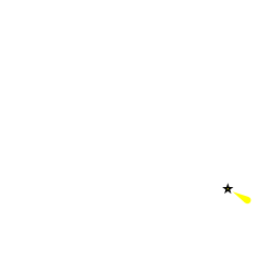
There are ![]() islets and shoal patches [[Brna#islets and shoal patches|islets and shoal patches]] 42°53.680'N, 016°48.262'E off the coast in the approach to Brna from the W and careful attention to the chart is needed.
islets and shoal patches [[Brna#islets and shoal patches|islets and shoal patches]] 42°53.680'N, 016°48.262'E off the coast in the approach to Brna from the W and careful attention to the chart is needed.
There are no dangers in the approach from the S and the E. The harbour is situated to the N of a wooded peninsula that protects it from E and S. Depths in the approach are 15.0 metres and in the harbour range from 12.0 metres in the centre of the harbour to 3.0 - 4.0 metres on the ends of the jetties and just 0.5 metres on the quays.
Entrance
Vela Luka is the nearest year-round port of entry.
Berthing

Town jetties
The only suitable berth for a visiting yacht is on the end of the jetty at the W end of the harbour, which is marked with a red port beacon, or the smaller jetty further E. Both jetties are lined with tyres or large black rubber fenders, which makes going alongside a little tricky. A mooring plank is an advantage, especially since the W jetty also has a ledge at water level. Shelter here is good except in W or SW winds when there is an unpleasant swell in the harbour.
reAn alternative berthing option, if the end of the jetty is occupied, is to drop anchor in 7.0 - 8.0 metres and go bows-to the quay wherever there is space. Depths along the quay are mostly 0.5 metres only. Much of the quays is occupied with small craft moorings, but it is possible to nudge in with care.Marinas & Yacht Clubs
None.
Anchorages
U. Istruga
Luka Brna
Amenities
| Facilities | |
|---|---|
| Water | N/A (Not Available) |
| Electricity | N/A |
| Toilets | N/A |
| Showers | N/A |
| Laundry | N/A |
| Garbage | Bins near the town quay |
| Supplies | |
| Fuel | N/A |
| Bottled gas | None |
| Chandlers | None |
| Services | |
| Repairs | N/A |
| Internet | WiFi in internet cafes |
| Mobile connectivity | Is there mobile telephone signal such as G4, G3, GPRS on the island? How strong is the signal? Are there any blind spots? |
| Vehicle rentals | N/A |
| Health | |
Provisioning
![]() In the Village [[Brna#In the Village|In the Village]] Supermarkets and other provisions shops.
In the Village [[Brna#In the Village|In the Village]] Supermarkets and other provisions shops.
Eating out
- In the Village
-
 [[Brna# | ]] Several restaurants and café/bar.
Transportation
Local bus service to Korčula (town) and Vela Luka.
Tourism

The village ashore is attractive and there are some good walks in the hills around, but otherwise, there is little to do here.
Links
- Brna at the Wikipedia
Also see Croatia.
References
See Croatia.
Comments
We welcome users' contributions to the Wiki. Please click on Comments to view other users' comments, add your own personal experiences or recommend any changes to this page following your visit.
Verified by
Date of member's last visit to Brna and this page's details validated:
- August 2005 --Athene of Lymington
| This is a usable page of the cruising guide. However, please contribute if you can to help it grow further. Click on Comments to add your personal notes on this page or to discuss its contents. Alternatively, if you feel confident to edit the page, click on the edit tab at the top and enter your changes directly. |
| |
|---|
|
Names: Lighthouse, Athene of Lymington |