The archipelago is a collection of granite islands, islets and rocks located in about 6 NM SE of Bonifacio in Corse-du-Sud. This is the southernmost point of France in Europe.
Cavallo, the only inhabited, with its two islets: San Baïnso and Camaro Canto
Lavezzo (Corsican: Lavezzu), on which the lighthouse was built in 1874.
And a few islets:
Porraggia
Ratino
Piana
Perduto (Sperduto) and the rock of Sperduto
The island of Lavezzo is often refered to as Lavezzi, which appears to be incorrect according to various French and Italian sources.
Contacts
Navigation
Passe de Piantarella
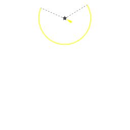
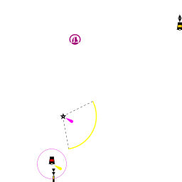
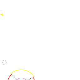
The Passe de Piantarella is a navigable passage between the islets of Porraggia and the rocky area of îles Gavetti next to Corsica shore towards the Piana island. It is marked by a pair of transits: at the Punta Sperono and the NE coast the Piana with bearing 228.5° (or 48° if heading SE).
Entrance
Berthing
At the Porto di Cavallo
Porto di Cavallo
Porto di Cavallo/wiki/Lavezzi_archipelago#Porto_di_Cavallo
It is the only and a very expensive marina at the archipelago. The approach to the marina is marked by a 4 red/green buoys. In high season their prices are prohibitively high for an ordinary sailor. It is not clear if this marina is open out of season. In any way it's essential to contact the marina before taking an approach. VHF 9; Tel. +33 0495 258011 ; mob. +33 672363370 (Enrico).
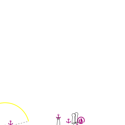
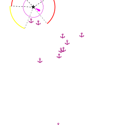
Anchorages
The anchorages on the archipelago are regulated by the authorities. For details check with the diagrams in this document.
It is a popular spot at the SW side of the island. Opened to S. Good holding at depths 3-5m. There are some mooring buoys for tripper boats are installed at the cove. Tripper boats leave at about 1600, so they can be taken for an overnight, stay, but they must be vacated before the tripper boats arrive next day (around 1000).
Cala di U Ghiuncu
Cala di U Ghiuncu/wiki/Lavezzi_archipelago#Cala_di_U_Ghiuncu
anchorageCala di U Ghiuncu [[Lavezzi archipelago#Cala di U Ghiuncu|Cala di U Ghiuncu]] 41°20.192'N, 009°15.358'ECala di U Ghiuncu41.33653;9.25596
Just E of the Cala Lazarina tends to be less crowded. It is well protected from Easterlies. Again there are a few tripper boat's buoys in the cove (see above).
Warning: Beware of an unmarked shoal/wiki/Lavezzi_archipelago#unmarked_shoaldangerunmarked shoal [[Lavezzi archipelago#unmarked shoal|unmarked shoal]] 41°20.100'N, 009°15.280'Eunmarked shoal41.335;9.25466 W of the entrance to the cove. Contrary to that's drawn at the Navionics charts the depth there are apparently less than 2.5 m: a 40" yacht was noticed running on the rocks there. SHOM charts give just 0.6 m depth at this location.
Cala di U Grecu
Cala di U Grecu/wiki/Lavezzi_archipelago#Cala_di_U_Grecu
anchorageCala di U Grecu [[Lavezzi archipelago#Cala di U Grecu|Cala di U Grecu]] 41°20.528'N, 009°15.607'ECala di U Grecu41.34214;9.26012
The approach for the one on the east is well marked with yellow buoys forming a channel. Watch out for rocks on both sides. The space is very small and it gets very busy in high season. Not protected from winds apart from SW. Depths of about 3m.
Cala della Chiesa
Cala della Chiesa/wiki/Lavezzi_archipelago#Cala_della_Chiesa
anchorageCala della Chiesa [[Lavezzi archipelago#Cala della Chiesa|Cala della Chiesa]]
is located at the NW of the island there are two anchorage spots in the inlets: Cala della Chiesa S inlet/wiki/Lavezzi_archipelago#Cala_della_Chiesa_S_inletanchorageCala della Chiesa S inlet [[Lavezzi archipelago#Cala della Chiesa S inlet|Cala della Chiesa S inlet]] 41°20.714'N, 009°15.175'ECala della Chiesa S inlet41.34524;9.25292 and Cala della Chiesa E inlet/wiki/Lavezzi_archipelago#Cala_della_Chiesa_E_inletanchorageCala della Chiesa E inlet [[Lavezzi archipelago#Cala della Chiesa E inlet|Cala della Chiesa E inlet]] 41°20.944'N, 009°15.411'ECala della Chiesa E inlet41.34906;9.25685. Both said to be difficult to access and suitable only for settled weather.
Cavallo island
Cala di Zeri
Cala di Zeri/wiki/Lavezzi_archipelago#Cala_di_Zeri
anchorageCala di Zeri [[Lavezzi archipelago#Cala di Zeri|Cala di Zeri]] 41°22.216'N, 009°16.115'ECala di Zeri41.37026;9.26859
A popular anchorage at the NE; good shelter from the Mistral.
Cala di Palma
Cala di Palma/wiki/Lavezzi_archipelago#Cala_di_Palma
anchorageCala di Palma [[Lavezzi archipelago#Cala di Palma|Cala di Palma]] 41°21.888'N, 009°16.154'ECala di Palma41.364798;9.269240
The access is fringed by rocks. Anchor at 3-4 m on sand. There is a jetty in the head with 1.5 m depth.
Cala di U Ghiuncu
Cala di U Ghiuncu/wiki/Lavezzi_archipelago#Cala_di_U_Ghiuncu
anchorageCala di U Ghiuncu [[Lavezzi archipelago#Cala di U Ghiuncu|Cala di U Ghiuncu]] 41°22.002'N, 009°15.268'ECala di U Ghiuncu41.366698;9.254468
Take care of the rocks at both sides of the entrance. Anchor at 5-10 m.
Cala di U Grecu (Cavallo)
Cala di U Grecu (Cavallo)/wiki/Lavezzi_archipelago#Cala_di_U_Grecu_.28Cavallo.29
restrictedCala di U Grecu (Cavallo) [[Lavezzi archipelago#Cala di U Grecu (Cavallo)|Cala di U Grecu (Cavallo)]] 41°22.400'N, 009°15.727'ECala di U Grecu (Cavallo)41.37334;9.26211
Between N tip of the island and Corsica. Warning: Take care of a shoal at S. Anchoring further N is prohibited due to submarine pipeline.
Plage Petit Sperone
Plage Petit Sperone/wiki/Lavezzi_archipelago#Plage_Petit_Sperone
anchoragePlage Petit Sperone [[Lavezzi archipelago#Plage Petit Sperone|Plage Petit Sperone]] 41°22.205'N, 009°13.424'EPlage Petit Sperone41.37009;9.22374
Between S tip of the island and Petit Sperone beach. Warning: Take care of a shoal at N. Anchoring further E,SE is prohibited.
Calla do Ciappili
Calla do Ciappili/wiki/Lavezzi_archipelago#Calla_do_Ciappili
anchorageCalla do Ciappili [[Lavezzi archipelago#Calla do Ciappili|Calla do Ciappili]] 41°22.022'N, 009°12.830'ECalla do Ciappili41.36703;9.21383
Warning: Take care of the swimming zone at the head of the cove.
Amenities
Facilities
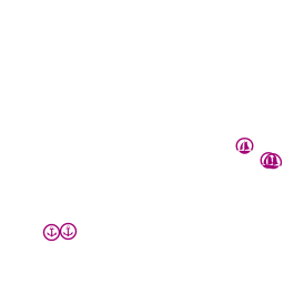
Water
Electricity
Toilets
In the marina
Showers
In the marina
Laundry
None
Garbage
Supplies
Fuel
None
Bottled gas
None
Chandlers
None
Services
Repairs
None
Internet
Mobile connectivity
Vehicle rentals
Cavallo: bicycles and electric cars
Provisioning
Cavallo
Grocery shop ”Epicerie des Pêcheurs”
Eating out
Cavallo
“Le Bistrot” bar-restaurant at the harbour
Café "Era Ora"
Restaurants at the "Hotel des Pecheurs" nearby
Transportation
Cavallo
Ferry to Piantarella at the SE tip (opposite Piana island) of Corsica (€15 one way).
Tourism
Sémillante cementery
Lavezzo island
On the island there are 2 cemeteries with casualties of the famous shipwreck in 1855 of french frigate Sémillante, in which 700 people died. One cemetery is for the captain and priest alone, and the other is for the remaining 698 people.
Cavallo island
Approaching the Cavallo island
Known for golfing and sailing, there is also a commercial area with restaurants and shops, along with the luxury Hotel & Spa des Pêcheurs. Only bicycles and electric cars are allowed on the island.
Warning: As per the French legislation the shoreline is in the public domain (Domaine Public Maritime) despite of this there are a number of reports of the visitors being bullied by the island's private guards. In such a case: (1) make sure you're in a public domain territory, if so (2) ask them to bring the local police (there are 2 policemen on the island; +33 (0) 495 705128). Usually then the guards go away.
We welcome users' contributions to the Wiki. Please click on Comments to view other users' comments, add your own personal experiences or recommend any changes to this page following your visit.
Verified by
Date of member's last visit to Lavezzi archipelago and this page's details validated:
This page has an outline in place but needs completing. Please contribute if you can to help it grow further. Click on Comments to suggest further content or alternatively, if you feel confident to edit this page, click on the edit tab at the top and enter your changes directly.